Showing posts with label Colorado. Show all posts

Saturday, August 28, 2010

Day 54 Summer 2010 Park to Park Road Trip

Today we leave Colorado Springs CO and head into Kansas.  Didn’t take too many photos today, the spectacular scenery is behind us.   Here are a couple of photos between Colorado Springs CO and the Kansas State Line.
6450 US-24 CO btwn Colorado Springs and I-70 Limon CO6458 I-70 btwn Limon CO and the Kansas border CO
Crossed the line from Colorado into Kansas.
6459 I-70 btwn the Kansas border and Hays KS
And now some photos between the Kansas State Line and our hotel in Hays KS.  Where are the mountains ?
6461 I-70 btwn the Kansas border and Hays KS6467 I-70 btwn the Kansas border and Hays KS
We are heading South and East, our plan is to head for Afton Oklahoma on Route 66.
To see the few photos that we took today, you can click on the link to my FLICKR site.

Friday, August 27, 2010

Day 53 Summer 2010 Park to Park Road Trip.

A day off…. We have reserved 2 nights at this hotel in Colorado Springs. Today I will try to get caught up with uploading the photos to Flickr. One thing that Utah hotels do not have is a good reliable high speed connection. One night I think that 2 tin cans and a piece of string would have transferred my photos quicker than the connection I had. Since we have been in Colorado, I have noticed a vast improvement In the wi-fi connection speeds at the hotels we are staying at.
Karen did laundry today and we ordered a pizza for delivery to our room for dinner.
We will be back on the road again tomorrow, heading South and East. Our plan is to get onto Route 66 and to visit some of the places that were closed on our Route 66 trip in 2008. We will also re-visit some of our favourite spots and people that we met 2 years ago.
Only 4 Photos taken today, the camera is having a well deserved day off.
Here they are,  first one is of me at my laptop plotting our route home from Colorado Springs.   The others are photos that Karen took outside the hotel.
6444 Planning our road trip home CO
6445 view from hotel Colorado Springs CO6446 view from hotel Colorado Springs CO6447 view from hotel Colorado Springs CO

Thursday, August 26, 2010

Day 52 Summer 2010 Park to Park Road Trip.

Today we will drive from Gunnison Colorado to Colorado Springs Colorado. A distance of about 300 KM.
We only took 56 photos today, far short from our usual 300 plus photos per day. The scenery is less spectacular, so I think this accounts for the drop in photos. Here are some of the photos that we took today.
6385 US-50 CO6387 US-50 CO
The road we are travelling on has a 7% grade, feels like we are running level compared to that 16% grade a few days ago. There is a runaway truck lane ahead just in case a truckers brakes fail.
6390 US-50 CO
We are now driving on the Collegiate Peaks Scenic Byway… Here are more scenery photos as we drive along.
6394 US-285 Collegiate Peaks Scenic Byway CO6395 US-285 Collegiate Peaks Scenic Byway CO6399 US-285 Collegiate Peaks Scenic Byway CO
6409 US-24 CO6413 US-24 CO
Our original plan for this afternoon was to go for a ride on the Pikes Peak Cog Railway, however when we arrived, the driving in the area around the railway station was a zoo, everyone was jostling for the few parking spots that there were and boarding time was 20 minutes away. It just all seemed too overwhelming to me, and I just wanted to get away from the madness. We will have to do further research and plan to come back for a ride in a less busy season.
We then went to visit and drive through the Garden of the Gods. This is a little park in Colorado Springs. We stopped at the visitor center to buy some postcards.
6423 Garden Of The Gods CO6424 Garden Of The Gods CO6425 Garden Of The Gods CO
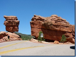
We saw Balanced Rock.
6430 Garden Of The Gods Balanced Rock CO6432 Garden Of The Gods Balanced Rock and Steamboat Rock CO
And a few other rockscapes.
6438 Garden Of The Gods CO6443 Garden Of The Gods CO
But I guess to my eye and after seeing Monument Valley, Mexican Hat, Yosemite NP, Zion NP, Yellowstone NP… etc… I know it is unfair to compare those National Parks to this city park, but I was quickly losing interest and after making a wrong turn and not knowing which road to follow, we gave up and headed for our hotel in Colorado Springs CO.
We will be leaving Colorado in a couple of days and continuing our return Eastward towards home. We will be leaving the beauty of Utah, Nevada, Washington, Oregon, California, Arizona, Nevada and Colorado behind us. As we travel East from here we won’t see much beauty in the landscape unless you like the flat prairies of Kansas and certainly after we cross over the Mississippi, we will be into all that urban sprawl of Illinois, Indiana, Michigan and Ontario. We have made lots of notes and written down lots of places to return to, things to do and see on our next vacation to this part of the USA.
To see all of our photos from today, you can find them on my FLICKR site.

Wednesday, August 25, 2010

Day 51 Summer 2010 Park to Park Road Trip

Today we will visit Black Canyon of the Gunnison National Park. This is the newest of the National Parks, Bill Clinton changed it from a National Monument to a National Park in 1999.

We entered the park and showed our park pass, then went to the Visitor Center.

6057 Black Canyon of the Gunnison National Park CO6059 Black Canyon of the Gunnison National Park CO6060 Black Canyon of the Gunnison National Park  South Rim Rd Visitor Center CO

At the visitor center is the first viewpoint of about 12 viewpoints along the South Rim Road.

6061a Black Canyon of the Gunnison National Park  South Rim Rd Gunnison Point Overlook CO6063 Black Canyon of the Gunnison National Park South Rim Rd Gunnison Point Overlook CO6064 Black Canyon of the Gunnison National Park South Rim Rd Gunnison Point Overlook CO

Next was Pulpit Rock Overlook. It took 2 million years for the Gunnison River to carve these canyon walls. It is about 2000 feet to the bottom.

6079 Black Canyon of the Gunnison National Park South Rim Rd Pulpit Rock Overlook CO6086  Black Canyon of the Gunnison National Park South Rim Rd Pulpit Rock Overlook CO6087  Black Canyon of the Gunnison National Park South Rim Rd Pulpit Rock Overlook CO

Devils Overlook.

6103  Black Canyon of the Gunnison National Park South Rim Rd Devil's Overlook CO6106 Black Canyon of the Gunnison National Park South Rim Rd Devil's Overlook CO

Chasm View.

6113 Black Canyon of the Gunnison National Park South Rim Rd Chasm View CO6122 Black Canyon of the Gunnison National Park South Rim Rd Chasm View CO

Painted Wall. This is the highest cliff in Colorado at 2300 ft. The patterns in the rock face were created more than a billion years ago when molten rock filled the fractures and joints in the existing rock, then cooled and hardened.

6126 Black Canyon of the Gunnison National Park South Rim Rd Painted Wall CO6134 Black Canyon of the Gunnison National Park South Rim Rd Painted Wall CO Stitch

Dragon Point.

6149 Black Canyon of the Gunnison National Park South Rim Rd Dragon Point CO6154 Black Canyon of the Gunnison National Park South Rim Rd Dragon Point CO

Sunset View.

6169 Black Canyon of the Gunnison National Park South Rim Rd Sunset View CO6179 Black Canyon of the Gunnison National Park South Rim Rd Sunset View CO

High Point. This is the end of the road and we turn around and head back towards the visitor center.

6185 Black Canyon of the Gunnison National Park South Rim Rd High Point CO6194 Black Canyon of the Gunnison National Park South Rim Rd High Point CO

From the visitor center we head out on the East Portal Road. This road will dead end in about 12 miles, but it promises to be a great drive. The sign says extreme grades and sharp curves.. sounds like fun. We have driven on steep grades before, but never as much as 16%

6200  Black Canyon of the Gunnison National Park East Portal Rd CO6201 Black Canyon of the Gunnison National Park East Portal Rd CO

6206 Black Canyon of the Gunnison National Park East Portal Rd CO6212 Black Canyon of the Gunnison National Park East Portal Rd CO6216 Black Canyon of the Gunnison National Park East Portal Rd CO

At the bottom of the road is the Gunnison Diversion Dam which was built to divert water from the river through a 5 mile tunnel through the mountain and out the other side to provide water for the fields and homes in the Uncompahgre Valley.

6232 Black Canyon of the Gunnison National Park East Portal Rd Gunnison Diversion Dam CO6234 Black Canyon of the Gunnison National Park East Portal Rd Gunnison Diversion Dam CO

And a bit further along is the Crystal Dam. You can’t see too much because the area is fenced off.

6251 Black Canyon of the Gunnison National Park East Portal Rd Crystal Dam CO

We turned around and headed back to the top. Climbing the 16% grade was a bit of a chore for our car but we made it.

6256  Black Canyon of the Gunnison National Park East Portal Rd CO6262  Black Canyon of the Gunnison National Park East Portal Rd CO

When we got back to the top, there were several cows in the road blocking our way.

6300 Black Canyon of the Gunnison National Park East Portal Rd CO6304 Black Canyon of the Gunnison National Park East Portal Rd CO6308 Black Canyon of the Gunnison National Park East Portal Rd CO

We got onto US 50 and headed towards our hotel in Gunnison CO. US 50 passes through the Curecanti Recreational Area.

6325 US-50 Curecanti National Recreation Area CO6330 US-50 West Elk Loop Scenic Byway Curecanti National Recreation Area CO6345 US-50 West Elk Loop Scenic Byway Curecanti National Recreation Area CO

To see all of our photos from today, you can find them on my Flickr site.