Showing posts with label Saskatchewan. Show all posts

Sunday, July 22, 2012

Day 24 Summer 2012 Road Trip


Not much to write about today, only took 27 photos. 

We moved 360 km Eastward, from Regina Saskatchewan to Brandon Manitoba.
2115 Saskatchewan TC-1 East sign 2116 Saskatchewan TC-1 East - cattle

We passed by fields of flax.

2121 Saskatchewan TC-1 East - flax crop fields 2122 Saskatchewan TC-1 East - flax crop fields

We stopped in Moosomin SK for lunch.

2127 Saskatchewan Moosomin - grain elevator 2128 Saskatchewan Moosomin

Around 1pm we left Saskatchewan behind us and entered Manitoba.

2131 Manitoba TC-1 East - Welcome sign at border

We are seeing fields of golden wheat now.

2137 Manitoba TC-1 East 2138 Manitoba TC-1 East

We enter the City limits for Brandon Manitoba and head for our hotel.

2140 Manitoba TC-1A East - Welcome to Brandon sign 2142 Manitoba TC-1A East Brandon 2143 Manitoba TC-1A East Brandon

To see the photos we took today, you can find them on our FLICKR site.

Saturday, July 21, 2012

Day 23 Summer 2012 Road Trip

We awake in Swift Current this morning and are in no rush.  We get ready, have our breakfast and are on the road by 10:00 am.

We are on the Trans Canada Highway 1 heading East out of Swift Current and we see these oddly stacked bales of hay.  We wonder why they are stacked like this.   The speed limit is 110 km/hr so we are motoring along nicely.

2019 Saskatchewan TC-1 East - one on many hay bales piled in triangles on side of TC-1 2020 Saskatchewan TC-1 East

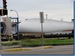
That is until we came upon this large obstacle.  I am surprised that there is not an escort vehicle, or any placards stating “wide load”, not even any flashing lights.   He is doing 120 km/hr, which is way too fast for towing something like that.  I just want to get around him before that thing falls off and blocks the whole highway.  As I approached he pulled over enough to let me by.   On closer examination we still could not figure out what he was towing.

2021 Saskatchewan TC-1 East 2022 Saskatchewan TC-1 East

We drove along the shores of Reed Lake SK.  We saw this large lake and the Reed Lake Grain Elevator when we were heading West several weeks ago.  We are re-tracing our route as we head back East.

2028 Saskatchewan TC-1 East Reed Lake - a saline lake 2031 Saskatchewan TC-1 East Reed Lake Pioneer grain elevator 2033 Saskatchewan TC-1 East Reed Lake - a saline lake

Reed Lake is a saline lake and we saw piles of sodium sulphate along the shore of the lake.  Sodium sulphate is basically sulphuric acid, so I guess we won’t be bothering to stop for a swim.

2036 Saskatchewan TC-1 East Reed Lake - a saline lake - Sodium sulfate which is the sodium salt of sulfuric acid 2037 Saskatchewan TC-1 East Reed Lake - a saline lake - Sodium sulfate which is the sodium salt of sulfuric acid

We arrived in Moose Jaw SK around noon and we are going to take a break from driving and visit “The Tunnels of Moose Jaw”.   These tunnels are beneath the streets and buildings of downtown Moose Jaw.  There are two tours you can take.  One is Passage to Fortune and the other one is The Chicago Connection. 

We chose the Chicago Connection tour.

We were told no still photography and no videos, so there are no photos of this tour.  Basically, as they tell the story, Al Capone the notorious gangster hid out in Moose Jaw and used these underground tunnels as his base of operation when things got too hot and heavy in Chicago.  We were shown Al’s office and his base of operation for the production of liquor that he then shipped back to Chicago using bootleggers during prohibition.   I have probably said too much already, because we were strictly told that what we see, what we hear, and what we smell, we can never tell anyone about this visit to the underground tunnels of Moose Jaw.  In fact we were told to “Fuhgeddaboutit” if you know what I mean.  I guess this also explains the rule of no photography or videos..  just forget everything that happened during the last hour down in the tunnels.
Personally, I believe the whole story is fictional.  I have googled Al Capone and I cannot find any record of him ever being in Moose Jaw.  I tend to believe that the tunnels were constructed back in the early days of Moose Jaw when the buildings were heated by steam and these are the access tunnels so that the workers could maintain the heating system and move around between the buildings to perform the heating and piping maintenance that was required for a steam heat system.    That’s my theory of the use and construction of the tunnels.  The Al Capone story seems a bit far fetched to me.

2049 Saskatchewan Hwy 2 (Main St N) Moose Jaw - The Tunnels of Moose Jaw sign 2053 Saskatchewan Hwy 2 (Main St N) Moose Jaw - The Tunnels of Moose Jaw - The Chicago Connection Tour 2056 Saskatchewan Hwy 2 (Main St N) Moose Jaw - The Tunnels of Moose Jaw - The Chicago Connection Tour entrance inside Java Express

Back up out of the tunnels, Karen went in search of a few of the Moose Jaw murals.

2065 Saskatchewan Moose Jaw historic downtown  - Murals of Moose Jaw - Old Time Threshing Bee 2075 Saskatchewan Moose Jaw historic downtown  - Murals of Moose Jaw - Main Street Moose Jaw 1920's 2085 Saskatchewan Moose Jaw historic downtown  - Murals of Moose Jaw - For the Veterans

We leave Moose Jaw behind and soon we see the City of Regina skyline off to the North of us.  We are staying the evening in Regina.

2102 Saskatchewan TC-1 - Regina skyline

Our hotel is in Downtown Regina.  My impressions of Regina are not that great after driving into the downtown core and checking into our hotel.  The area is a little questionable, but the hotel is fine, it is a Wingate by Wyndam and we won’t be going off the property.  Lots of sirens and street noises.  Oh well, it’s only one night.

To see all of our photos from today, you can find them on our FLICKR site.

Friday, July 20, 2012

Day 22 Summer 2012 Road Trip


We got up earlier than usual and had breakfast, then checked out of the hotel by 9:00 am. 

We are heading South of Lethbridge and going to visit Writing-on-Stone Provincial Park.

It is about a 2 hour drive from our hotel.  Along the way we saw this train hauling wind tu
rbine pieces.
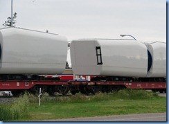
1728 Alberta Taber Hwy 3 East - train transporting wind turbine parts 1729 Alberta Taber Hwy 3 East - train transporting wind turbine parts 1730 Alberta Taber Hwy 3 East - train transporting wind turbine parts

We stopped in Taber AB to find the Uniroyal Gal, another roadside attraction.
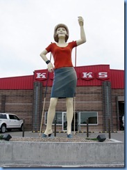
1731 Alberta Taber Hwy 36 - Uniroyal Gal

We had to get around this slow moving vehicle, a harvester on a trailer.

1740 Alberta  Hwy 36 South 1742 Alberta  Hwy 36 South

We stopped for a break at the Milk River Visitor Centre.  This is well designed and contained a lot of information about Alberta and the surrounding area.  There was a large Dinosaur outside.  Dinosaur bones can be found all throughout Alberta.

1764 Alberta corner Hwy 4 South & Hwy 501 East - Milk River Visitor Centre 1765 Alberta corner Hwy 4 South & Hwy 501 East - Milk River Visitor Centre - 36-foot tall tyrannosaurus-rex 1770 Alberta corner Hwy 4 South & Hwy 501 East - Milk River Visitor Centre - 36-foot tall tyrannosaurus-rex

There was an exhibit for the Buffalo Jump that we had visited a few days earlier.

1775 Alberta corner Hwy 4 South & Hwy 501 East - Milk River Visitor Centre - display inside Head-Smashed-In Buffalo Jump Provincial Park 1776 Alberta corner Hwy 4 South & Hwy 501 East - Milk River Visitor Centre - display inside Head-Smashed-In Buffalo Jump Provincial Park

We continued along our way and were warned not to run over any snakes.

1805 Alberta Hwy 500 South - Watch For Snakes On Road sign

We arrived at the entrance to the Writing-on-Stone Provincial Park.

1815 Alberta - Writing-On-Stone Provincial Park sign 1816 Alberta - Writing-On-Stone Provincial Park sign

There were several display boards outside showing the native pictographs that are found in this area.

1822 Alberta - Writing-On-Stone Provincial Park Visitor Centre - outside display 1825 Alberta - Writing-On-Stone Provincial Park Visitor Centre - outside display 1832 Alberta - Writing-On-Stone Provincial Park Visitor Centre - outside display

We went inside the visitor centre to learn more about this provincial park.

1838 Alberta - Writing-On-Stone Provincial Park Visitor Centre - outside display

There were many displays and presentations inside.  After looking at everything we went back out to our car to tour around the park.  This park has many hoodoos.  We have seen hoodoos before, they are basically spires of rock.  Very interesting to look at.

1866 Alberta - Writing-On-Stone Provincial Park - hoodoos 1874 Alberta - Writing-On-Stone Provincial Park - hoodoos 1881 Alberta - Writing-On-Stone Provincial Park - hoodoo

There are many native petroglyphs throughout the park, but they are in restricted areas and you can only see them on the park ranger led tours.  We were either too late or too early for the scheduled tours, but there is one petroglyph site that you can hike to that does not require an escorted tour.  We drove to the trail head and parked our car.  The hike is about 1 km in length.  This is called the Battle Scene Trail.

1893 Alberta - Writing-On-Stone Provincial Park - Battle Scene Trail sign

The trail was steep in places, but we made it through the hoodoos to the site of the petroglyphs.

1896 Alberta - Writing-On-Stone Provincial Park - Battle Scene Trail - hoodoos 1900 Alberta - Writing-On-Stone Provincial Park - Battle Scene Trail - Bill on trail 1901 Alberta - Writing-On-Stone Provincial Park - Battle Scene Trail - hoodoos & Bill on trail

It was rather disappointing, after hiking all that way, to find that the petroglyphs were barely visible on the rock face.  Eventually as time passes, and weathering continues they will disappear all together, but even now they are pretty faded.  You really have to look hard to find them.  According to the scratches in the rock, a large battle took place at this location.

1910 Alberta - Writing-On-Stone Provincial Park - Battle Scene Trail -The Battle Scene petroglyphs 1911 Alberta - Writing-On-Stone Provincial Park - Battle Scene Trail -The Battle Scene petroglyphs 1912 Alberta - Writing-On-Stone Provincial Park - Battle Scene Trail -The Battle Scene petroglyphs

Good thing there was a display sign to explain what we are looking at.

1913 Alberta - Writing-On-Stone Provincial Park - Battle Scene Trail -The Battle Scene petroglyphs sign

On the hike back up to the car we spotted a mule deer.

1921 Alberta - Writing-On-Stone Provincial Park - Battle Scene Trail (return) - Mule Deer 1922 Alberta - Writing-On-Stone Provincial Park - Battle Scene Trail (return) - Mule Deer 1924 Alberta - Writing-On-Stone Provincial Park - Battle Scene Trail (return) - Mule Deer

Back in the car, we exited the park and headed towards our hotel in Swift Current SK.
The drive was beautiful, a bit slow because of repaving, but there was lots to see along the way.

1935 Alberta Hwy 501 East 1940 Alberta Hwy 879 North 1945 Alberta Hwy 879 North

1956 Alberta Hwy 879 North 1964 Alberta Hwy 879 North 1965 Alberta Hwy 879 North

We have passed by many many fields of canola on this vacation, but this is the first time we have noticed bee hives set up near the fields.  In the fields amongst the canola are these tent like structures.
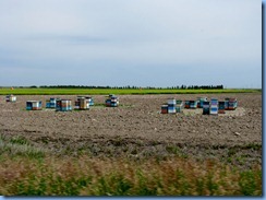
1966 Alberta Hwy 879 North - bee hives 1967 Alberta Hwy 879 North - orange tents are shelters for the bees which pollinate the canola 1968 Alberta Hwy 879 North - orange tents are shelters for the bees which pollinate the canola

In Bow Island AB we stopped for a late lunch and a photo opportunity with another roadside attraction.  This is Pinto MacBean.   Bow Island is the Pinto Bean capital of Alberta.
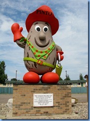
1977 Alberta Hwy 3 East Bow Island Tourist Information Centre - Pinto MacBean 1978 Alberta Hwy 3 East Bow Island Tourist Information Centre - Pinto MacBean

Passing through Medicine Hat AB along the Trans Canada Highway, we passed by the Saamis Teepee that we visited on our way to Calgary 3 weeks ago.

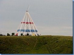
1993 Alberta TC-1 East - Medicine Hat - Saamis Teepee 1994 Alberta TC-1 East - Medicine Hat - Saamis Teepee

A half hour later and we are leaving Alberta behind us and crossing into Saskatchewan.

2002 Saskatchewan TC-1 East - border sign

We are surrounded again by oil well pumps of every size and description.
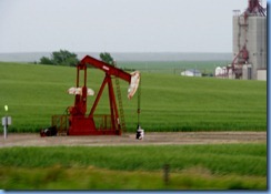
2005 Saskatchewan TC-1 East - one of many oil well pumps between Gull Lake & Webb 2010 Saskatchewan TC-1 East - two of many oil well pumps between Gull Lake & Webb 2012 Saskatchewan TC-1 East - one of many oil well pumps between Gull Lake & Webb

We arrived at our hotel in Swift Current.
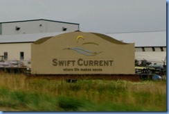
2013 Saskatchewan TC-1 East - Swift Current sign

It was a longer than usual day for us, up and out of the hotel by 9:00 am and then the hiking and walking around at the provincial park.  We are too pooped to go out for dinner so we order a pizza delivered to our room and take it easy for the rest of the evening. 

We can sleep in again tomorrow.

To see all of our photos from today, you can find them on our FLICKR site.